New discovery of a sunk longboat
near Disko Island, Godhavn, of possibly Norse origin
Erich Habich-Traut
Satellite Remote Sensing Analyst
'Our Planet Earth From Space'
http://opefs.com
Background and proposed initial survey of a shipwreck at Queqertarsuaq harbour,
Queqertarsuaq, Greenland.
I wish to thank James P. Delgado, Director of Maritime Heritage at NOAA, for his encouragement,
also Casper Tai Christiansen and Gitte Henricksen, from the Arctic Station of the University of Copenhagen,
Bo Albrechtsen, Jette Arneborg and Christian Koch Madsen, of the National Museum of Greenland,
Søren Michael Sindbæk and Jens Seeberg, of the Dept. of Anthropology, Aarhus University,
Stephen Fox and the Lofotr Viking Museum,
Ursula Warnke, Deutsches Schifffahrtsmuseum,
Peter Winterstein, Deutsche Gesellschaft zur Förderung der Unterwasserarchäologie,
Liselotte Theil, Archäologisches Institut der Universität zu Köln.
 1. INTRODUCTION
Disko Island lies in the Davis Strait, belonging to Greenland, it is the 84th largest island on Earth and lies 300 miles east of America (Canada).
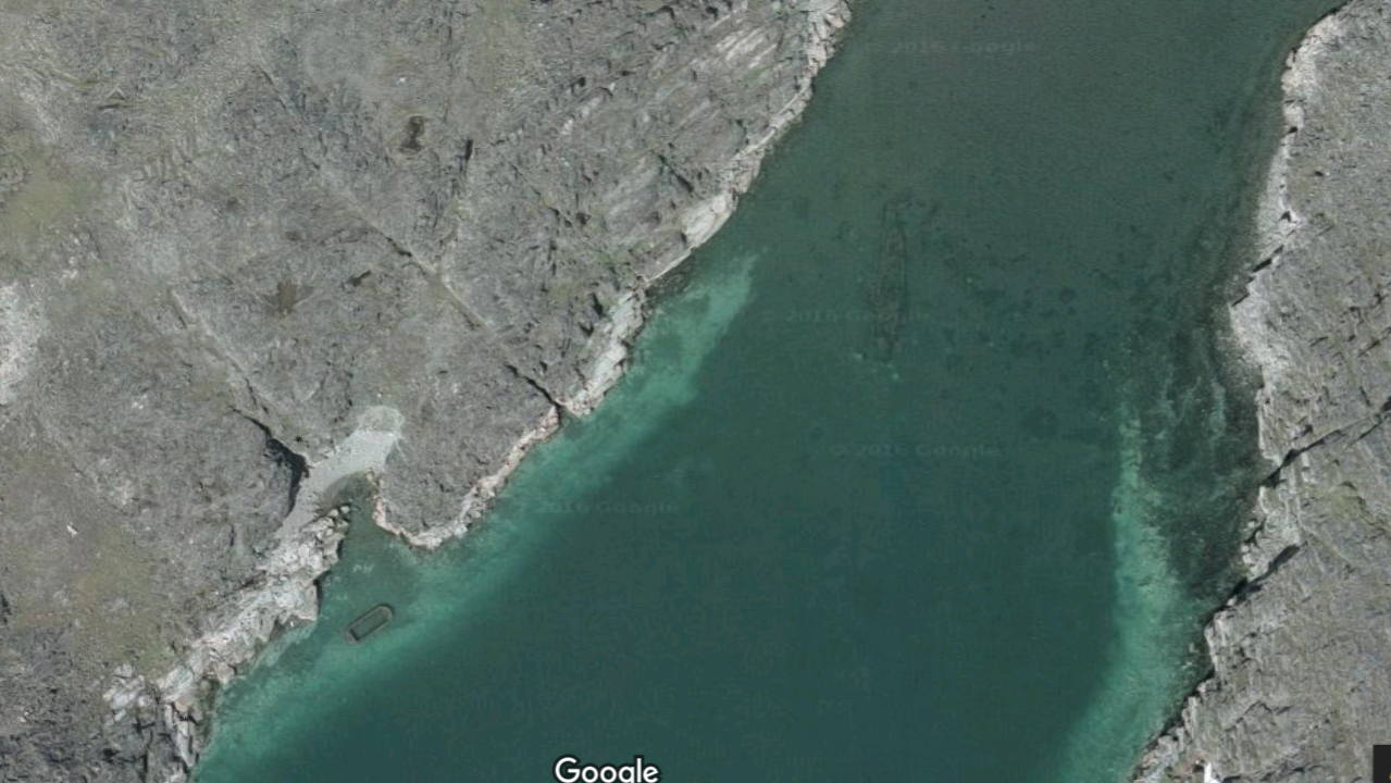
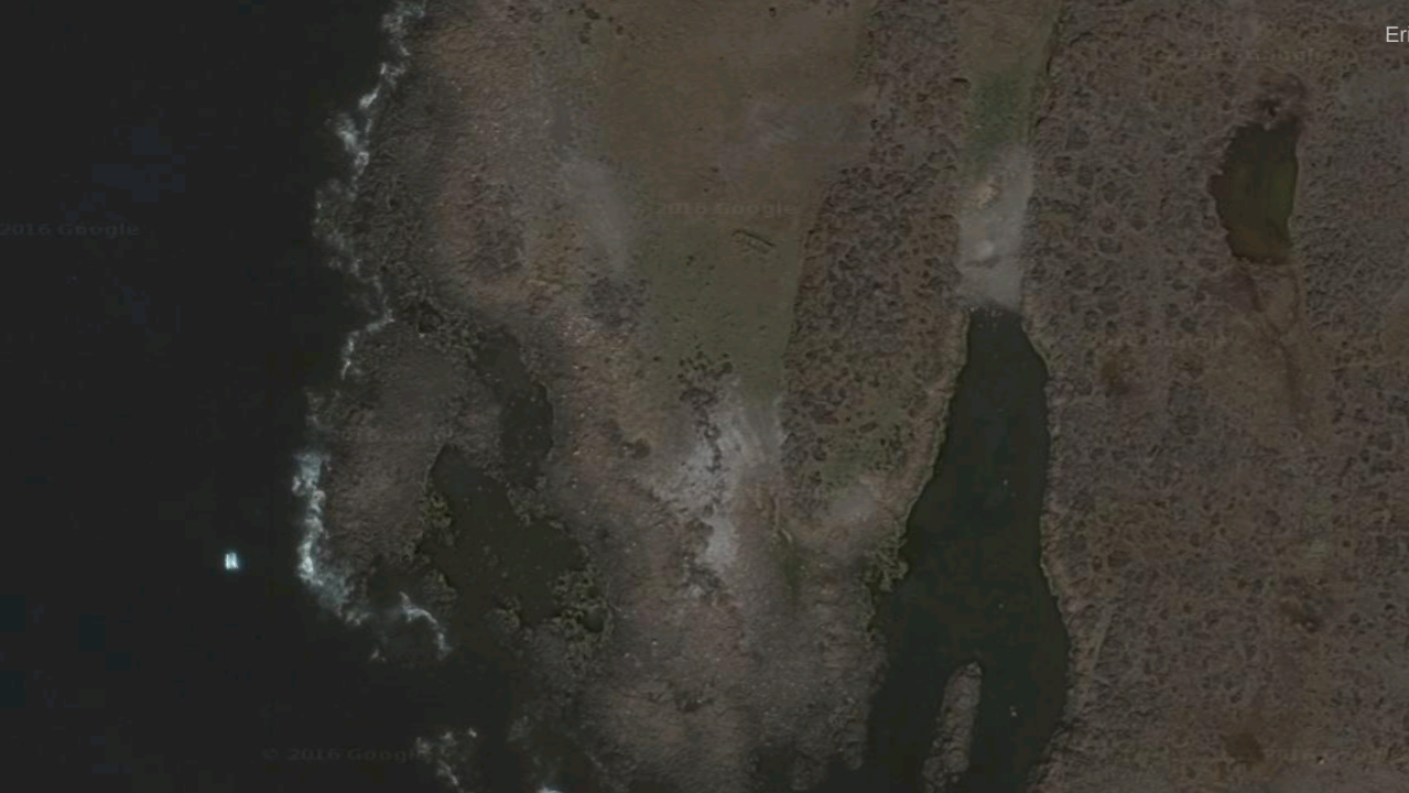
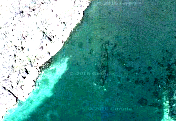
In the relatively shallow waters off the shore from Godhavn harbour I found in March 2016 via Google Earth a structure that I cannot explain.
Quite obviously it shows a shipwreck,
that I feel it should be the subject of an archaeological enquiry.
In 2017 Google reverted the high resolution satellite images shown here to a degraded version
that show nothing of interest in this location, therefore I'm now showing screenshots taken in March 2016.
I am attempting to describe the images.
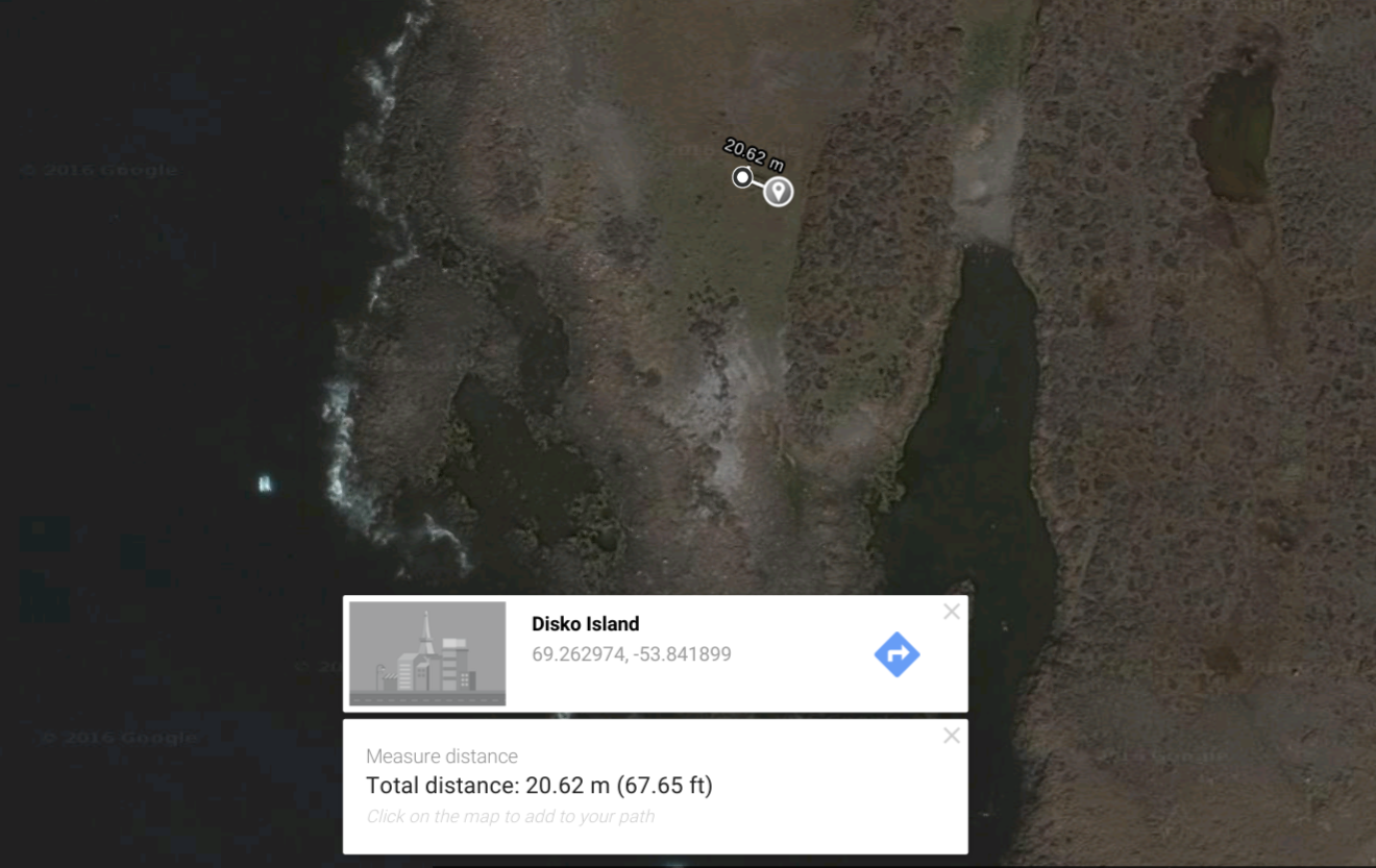
 Satellite image from March 2016
Location: 69°15'23.9"N 53°32'47.3"W
Satellite image from March 2016
Location: 69°15'23.9"N 53°32'47.3"W |
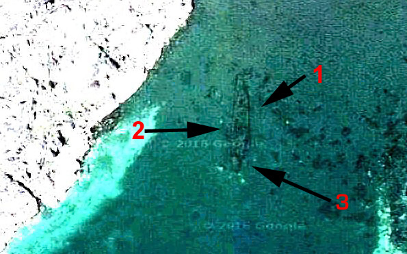
2. ANALYSIS OF UNKNOWN VESSEL:
It looks like a boat crashed against a rock,
seen in the southern direction (3). But that is subject to interpretation.
It could also be the cabin at the stern of a whaler.
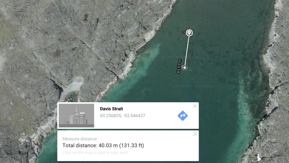
In the middle of the 40m structure,
the remains of what could have been a sail mast is visible (2).
This is also possibly the remains of a chimney.
I believe the dimensions of the boat are within expected parameters for a norse longship. Except, that it would be the biggest one ever found.
In the top third of this structure a cross beam is seen (1). |
The underwater feature has a length of 40 meters.
The biggest Viking longship discovered to date, the Roskilde 6, measures 36 meters.
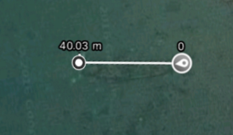
Length of the shipwreck at Godhavn |
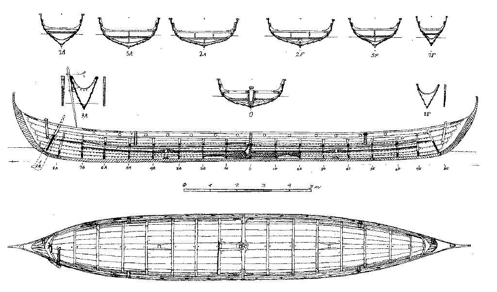
Comparison of the wreck with a longboat drawing |
The feature is only a few hundred meters from Godhavn on Disko Island, which apparently means "good harbour" in Danish.
3. PREVIOUS SURVEYS AT GODHAVN HARBOUR
In January 2017 I discovered that this shipwreck in Godhavn harbour is not the only one.
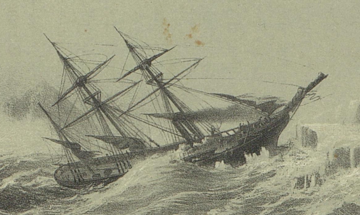 In 2003, the wreck of the steam yacht Fox in Godhavn was surveyed by James Delgado,
who is with the Institute of Nautical Archaeology in Texas today.
This survey was related to Sir John Franklin's Arctic expedition, who with two ships and a crew of 129 men from England, Ireland and Scotland sailed in 1845 to find the Northwest passage to America.
All men were last seen alive on the 26 July 1845 by Captain Dannett of the whaling ship Prince of Wales.
Search parties were launched soon after. Sir John Franklin's widow raised the money for a fourth search party in 1857.
For this purpose she purchased the steam yacht Fox for £2000 and gave its command to Francis Leopold McClintock from 1857 to 1859, to discover more about the fate of the missing expedition. After this the Fox resumed regular services not related to expeditions.
 In the Journal of Field Archaeology, Vol. 34, No. 1 (Spring, 2009),
James Delgado showed by example of the steam yacht Fox, that despite harsh conditions and icebergs, a shipwreck CAN survive the Arctic waters and provide valuable archaeological insights.
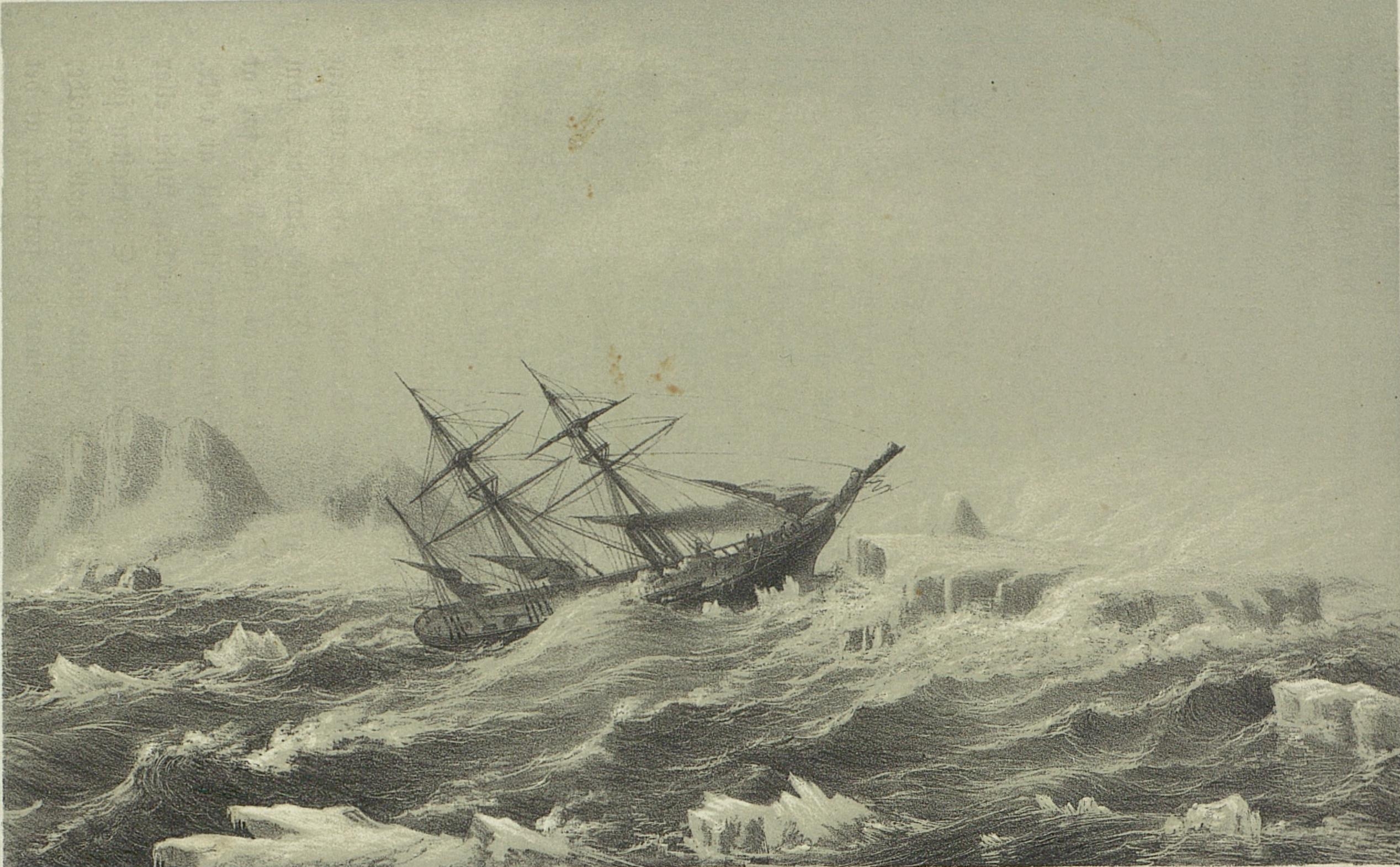
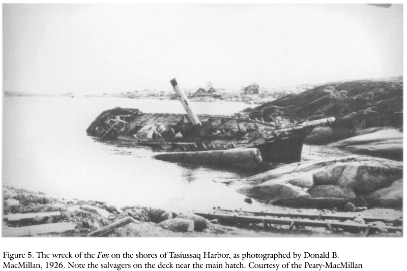
In 1926, the 'Fox' was declared unfit for repairs after an accident and left to the elements in Godhavn harbour. The picture on the left shows her after that date.
Both wrecks, the 'Fox' and the unknown one,
have a length of 40 meters, which first puzzled me.
But there is no possibility of a mix-up.
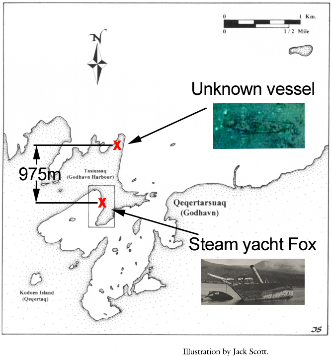 Unknown to James Delgado or anyone at the time,
the second shipwreck (unknown vessel) lies just 975 meters to the north from where his expedition dived.
Jim Delgado stayed in Arctic Station during his expedition in 2003.
I am also considering this option for 2017 or 2018.
For the past eight months I have been trying to raise interest in this unknown vessel with various archaeological experts.
I had prematurely identified the shipwreck as being a 'Viking longboat',
for which I had not presented any evidence.
If the shipwreck is a whaling ship,
it may not carry such huge archaeological interest as that of a Viking longboat,
but I am sure that it would be a boon to the community at Qeqertarsuaq.
From all the shipwrecks ever scientifically surveyed there have only ever been four to my knowledge, that were located in the High Arctic.
One is the steam yacht Fox, as described, another is the Maud, of explorer Roald Amundsen.
The third and fourth are the HMS Erebus in September 2014 and then in 2016 the HMS Terror (these links go to video),
both the lost ships of the fated Northwest passage expedition led by Sir John Franklin.
4. WHALING HISTORY OF DISKO ISLAND
 Is it possible that the unknown vessel at Godhavn harbour could be an early whaler?
The first whalers came to Qeqertarsuaq in the 18th century.
The town of Godhavn was founded by Svend Sandgreen in 1773,
a Danish whaler and merchant.
Disko Island and the town Godhavn became known as a base for whaling,
mirrored in it's coat of arms seen on the left.
Surveying the unknown vessel would be a chance to find an archaeological narrative for this period in the islands rich history.
5. PROPOSAL FOR INITIAL SURVEY
Since the shipwreck appears to lie in shallow water and it is located close to the shoreline,
a first exploration can be done with an underwater camera and a dinghy.
 It would be possible to use a simple waterproof action-cam attached to a long line, or a pole, together with a submersible flashlight to get confirmation of a structure underwater.
This non-intrusive approach would also be prefered to avoid the possibility of disturbance of an archaeological site.
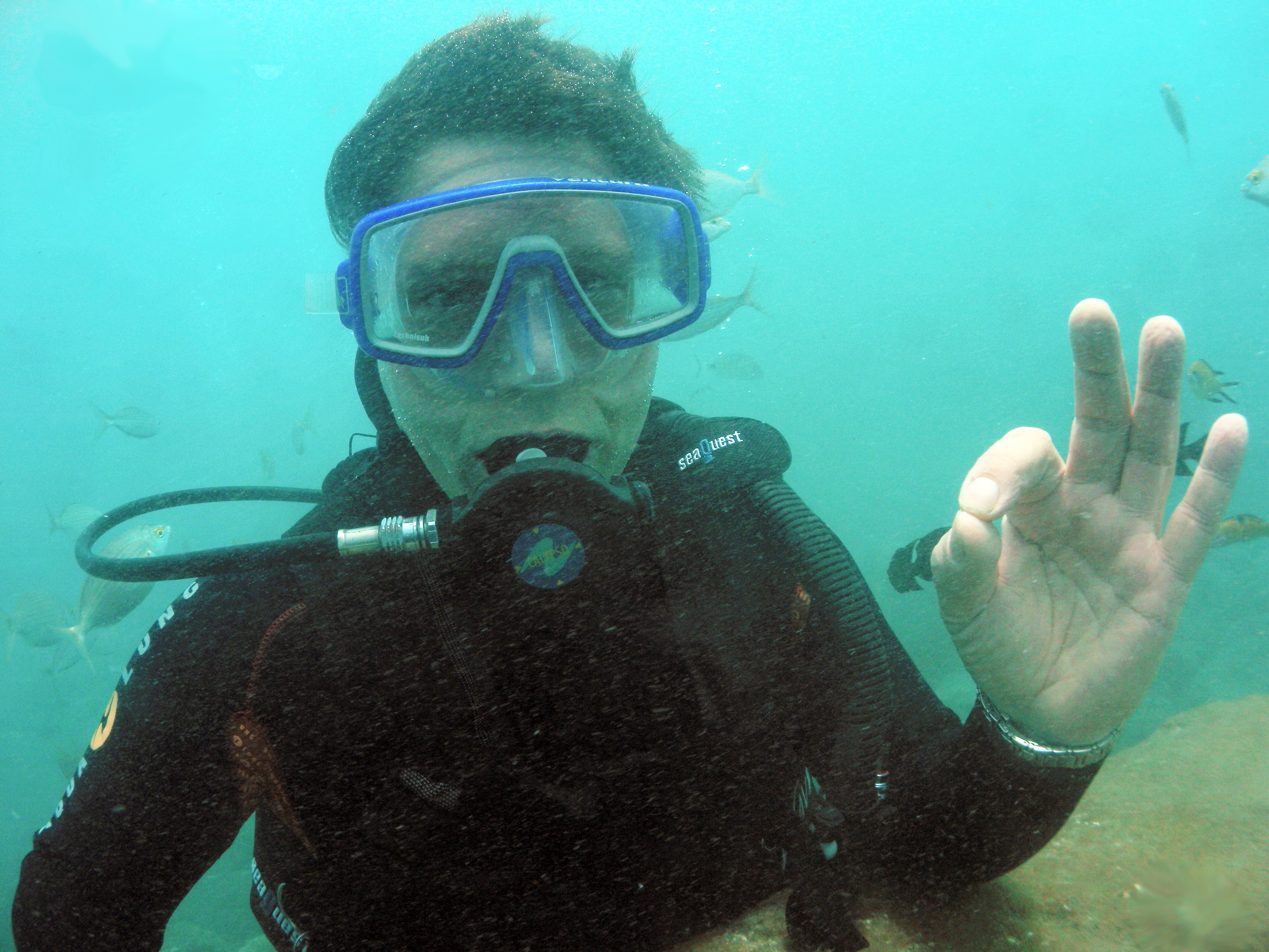
Using Scuba gear would be the method of choice to investigate a sunken shipwreck, but it carries additional cost due to the specialized gear required to dive in Arctic waters, which are quite cold at 1°- 2° Celsius.
The main cost for an initial survey expedition comes mainly from the travel and accomodation expense.
Since I am not affiliated with any University or Research group, the cost of staying at Arctic station could be around 100 Euros per day. I believe the survey objective can be reached in 7 days.
The cost of travelling to Godhavn from Copenhagen is given as approx. 1400 Euros.
The total cost of the expedition should not exceed 4000 Euro including hire of a rubber dinghy and field assistance.
I will be seeking sponsorships from expedition suppliers and crowdfunding will be tried to raise awareness of this expedition and to minimize the personal costs.
Sincerely,
Erich Habich-Traut,
Satellite Remote Sensing Analyst
http://opefs.com
Solingen, 21-25.02.2017
THE CASE FOR A NORSE LONGSHIP
6. PROXIMITY OF UNKNOWN VESSEL TO VIKING AMERICA ROUTE
The precise routes that Leif Erickson and Thorfinn Karlsefni took to America are uncertain.
With the exception of the Vinland map, whose authenticity is in doubt, Vikings are not known to have drawn maps.
The only reports that we have of their travels come from the Sagas.
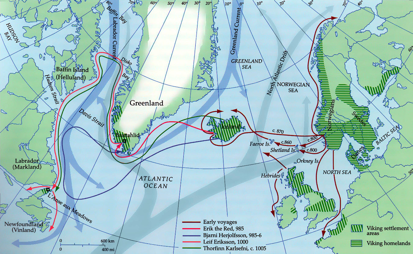
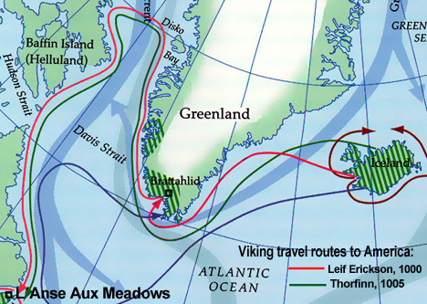 The Viking voyages to Iceland, Greenland and North America,
as reconstructed from the Norse sagas |
The map on the left shows the routes of the Viking voyages that have been inferred from a close reading of the surviving Sagas.
(Landmarks can be recognized and distances gauged from the number of days at sea.)
When the Vikings sailed to America, they would, as shown, travel up the West Coast of Greenland, cross the Davis Strait at Disko Island (only 200 miles wide at the closest point) and sail then down the East Coast of Baffin Island and Labrador.
Other routes for the travels of Viking ships to America have been proposed, for instance by the Draken expedition in 2016. However, those routes are point-to-point sails to known destinations with prior knowledge of the destination.
It is doubtful the Vikings knew were they were going exactly,
the first time. |
The proximity of Disko Island to the America route suggests the possibility that a Viking staging post for travels to America was set up on Disko Island.
7. TELLURIC IRON AS BALLAST
Vikings did travel to Greenland to set up settlements,
but few to no shipwrecks or longhouses are known to exist north of Nuuk, which lies 570km to the south.
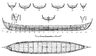
Outlines of shipwreck compared to
norse longship building plan |
The length of the shipwreck excludes that it was a locally built ship.
Its shape does suggest a Norse origin.
So what interests could Vikings have brought to Disko Island?
On Disko Island we find the largest deposit of native iron on Earth.
Iron played a major role in Norse shipbuilding,
as iron nails were used in the construction of the hull. |
![Rob Lavinsky, iRocks.com – CC-BY-SA-3.0 [CC BY-SA 3.0 (http://creativecommons.org/licenses/by-sa/3.0)], via Wikimedia Commons](../disko/Iron-136212.jpg)
Telluric iron, Disko Island, by Bob Lavinsky, irocks.com |
"Telluric (native) iron is extremely rare, with only one known major deposit in the world, located in Greenland."
That deposit is on Disko Island.
You can just walk around and pick up lumps of rock, very rich in iron,
which would have been a boon in extracting the metal.
Telluric iron exists in varying qualities. Only the carbon-poor variety, called Type II, can be used for tool making.
Other types are not ductile enough, but can be used for hammerstones.
|
Useful tools made by eskimos from telluric iron are found exclusively around Disko Bay,
where they constitute about 50% of all metal objects found from the Thule civilisation.
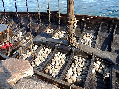
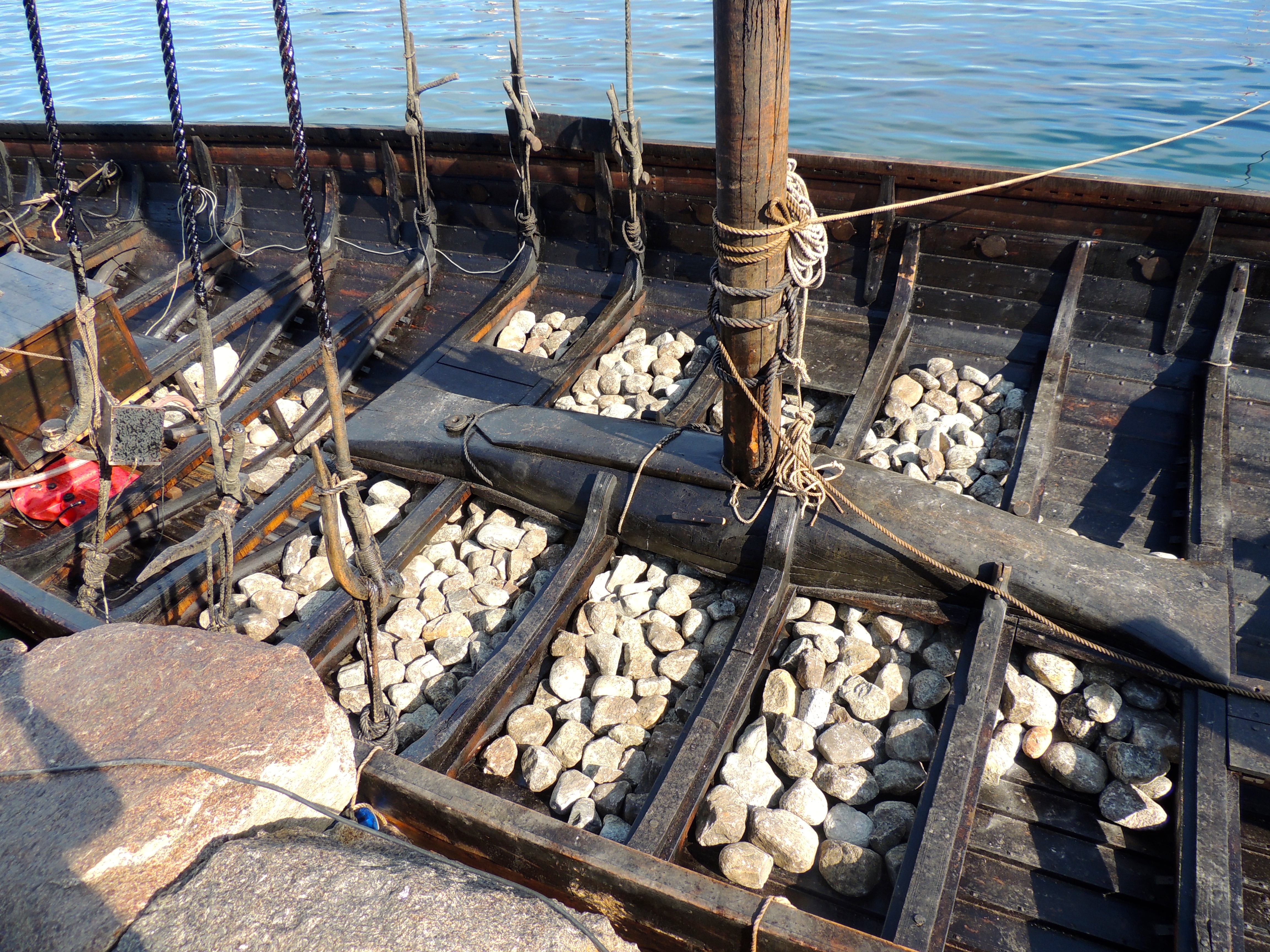
Ballast stones in the hull of a Viking vessel, reconstruction, by Stephen Fox, archaeofox.com |
One of the greatest dangers of Viking ships under full sail was capsizing.
To provide more stability, balast in the form of rocks was put into the hull.
A good dual purpose ballast on a Viking expedition with unknown destination would have been telluric iron from Disko Island, because of its high metal content and ease of collection.
|
Viking age shipbuilding is explained in this article and here.
ADDENDUM
8. THE (THULE) LONGHOUSE
Circling the island with Google maps, I came upon a rectangular shape, that looked like the foundations of a longhouse.
(The link longhouses in the Viking Age explains those dwellings in detail).
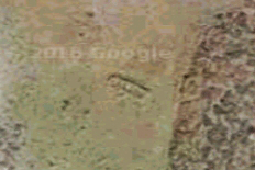
The rectangular outlines of stone
foundations of a longhouse |
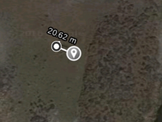 Length of the structure
20 meters |
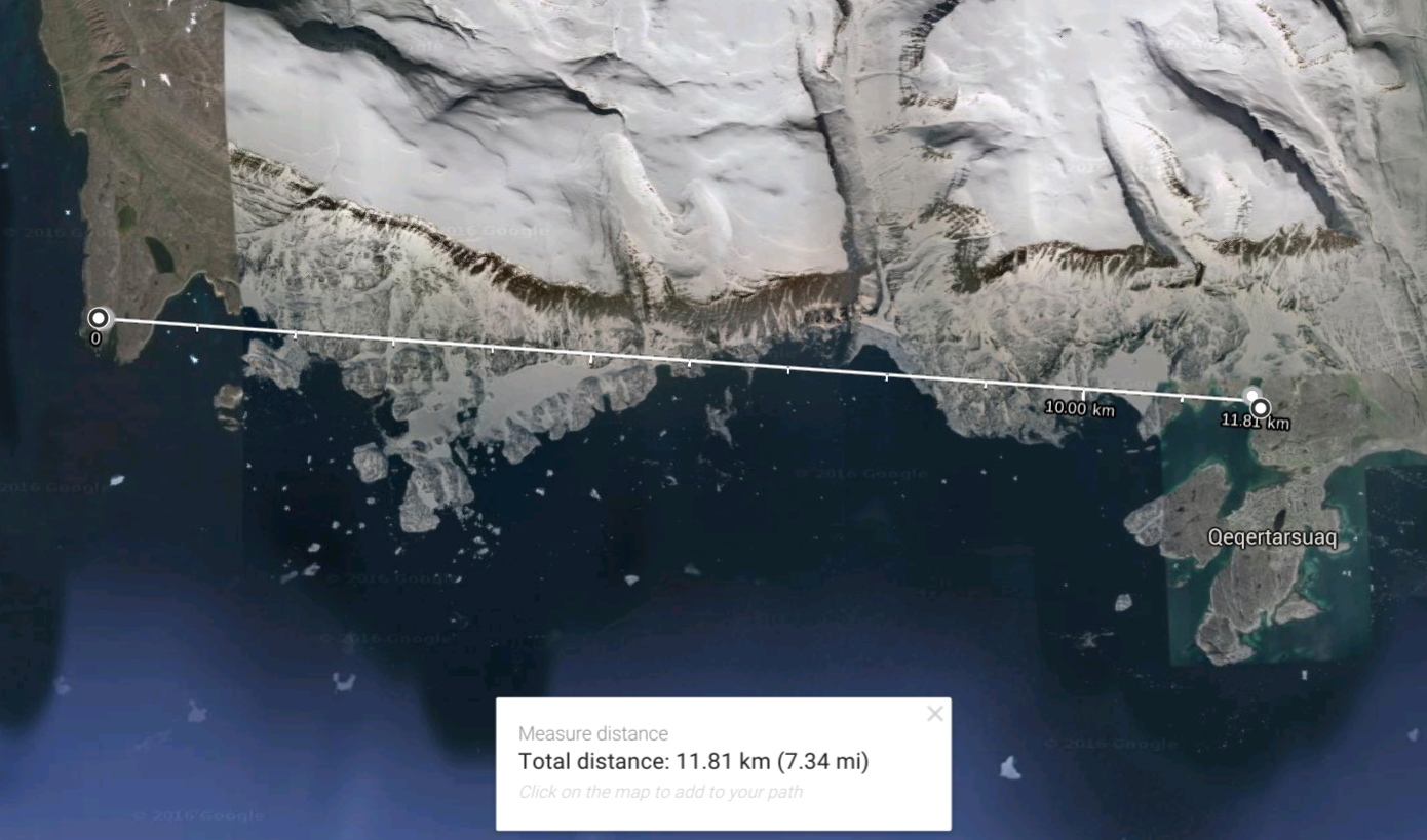 Distance of the longhouse
to the 'Viking longboat' |
The location of the Disko longhouse: 69°15'46.7"N 53°50'30.8"W, https://goo.gl/maps/D5UbzVwSWRw
It is situated approx. 11 km west from the shipwreck, the structure measures 20 meters in length.
The house appears to have had a stone wall base.
The longhouse was verified to exist by Bo Albrechtsen, who named it a Thule longhouse.
Bo Albrechtsen is deputy director of the National Museum of Greenland.
Bo Albrechtsen wrote:
"In the history of Greenland longhouses have been in use and occupied by different cultures:
Dorset, Norse and latest Thule culture have all such structures among their buildings.
The Dorset long house would probably be overgrown and not visible from the sky today.
The norse longhouse is well known from south Greenland - but not north of the Nuuk area.
Therefore I (Bo Albrechtsen) doubt this construction would be from the norse.
The longhouse of the Thule culture is well known all over Greenland.
It has been in use in the period from 1600 to 1920.
These structures are usually very clear in shape and I am sure the
longhouse west of Qeqertarsuaq belongs to these structures."
9. Disko Island as Thule?
This chapter investigates if the 'Thule' island shown in the map of Olaus Magnus and Disko Island are the same.
I shall make a case for a mistaken identification.
 When Bo Albrechtsen of the National Museum of Greenland
described my longhouse as belonging to the Thule civilisation,
he was referring to the ancestors of all modern Inuit.
They developed in coastal Alaska by 1000 CE and expanded eastwards across Canada, reaching Greenland by the 13th century.
The may have traded in combs made from natural materials.
The Greek explorer Pytheas is the first to have written of Thule, doing so after his travels between 330-320 BCE.
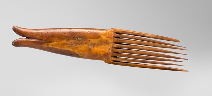
Thule civilisation comb from walrus ivory |
Trade goods arrived in Greece from Thule,
and Pytheas wanted to know of their origin.
He wrote of a land were the sun doesn't set for 24 hours,
locating Thule in the Arctic Circle.
|
Disko Island has been described as inhabited for 5500 - 6000 years.
However, when the Vikings came to Disko Bay around 1000 CE,
they described the area as uninhabited.
Since the proto-Inuit arrived after the Vikings, but not later than around 1300 CE,
who were the people that lived there before?
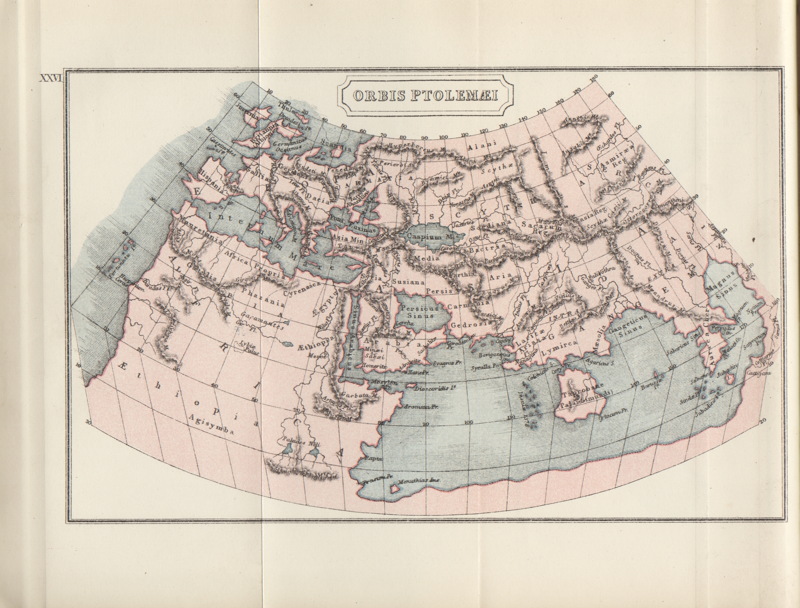
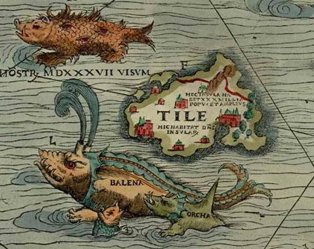
Another depiction of "Thule" from the 'Orbis Ptolemaei',
drawn after descriptions of Claudius Ptolemy of Alexandria in 150 CE. The map itself was drawn in 1535. |
Thule was a far-northern location in classical European literature and cartography.
It was often considered to be an island in antiquity,
modern interpretations often identify Thule as Norway.
Other interpretations include Orkney, Shetland, and Scandinavia. In the Late Middle Ages and Renaissance, Thule was often identified as Iceland or Greenland.
Scientists at the University of Berlin believe it was the island of Smola in Norway.
The term ultima Thule in medieval geographies denotes any distant place located beyond the "borders of the known world".
|
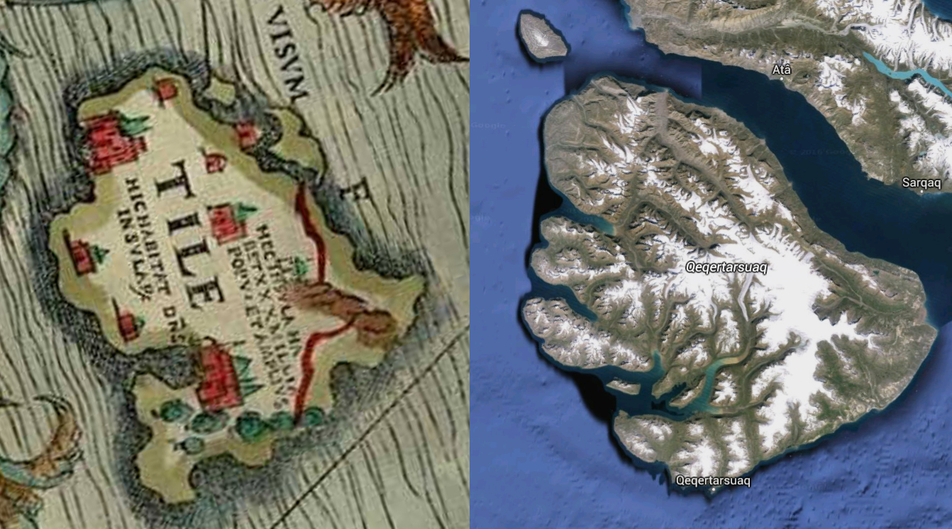
Visual similarities between Thule and Disko Island, based on Olaus Magnus's map
Disko Island was not officially charted until English explorers John Davis's third Greenland expedition in 1587.
After him the Davis Strait is named.
Disko Islands coastline was first encountered by Europeans when Erik the Red started a settlement in 985 CE on the more habitable western coast of Greenland and traveled up the coast during the summer thaw.
Their known interest in this area was due to its rich resources:
walruses for ivory, seals for their pelts, and whales for a variety of materials.
Could the Viking knowledge of the Disko Bay area have found it's way into the Carta Marina,
which was compiled before John Davis charted the area about 50 years later?
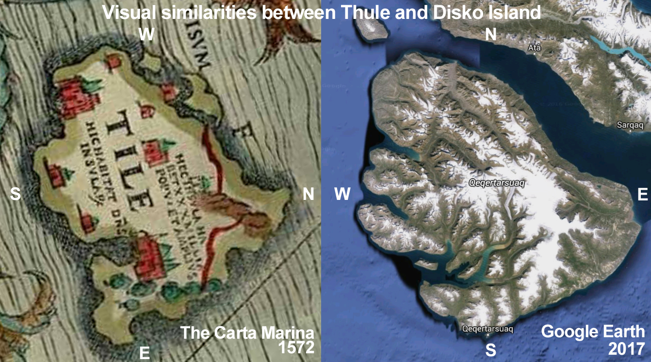 |
A vague similarity between Olaus Magnus ancient 'Carta Marina' map detail of "Tile" (Thule) from 1539 and modern satellite images of Disko Island can be seen, when the detail is rotated clockwise 90°, so that North is West.
Olaus Magnus compiled his map in Venice in 1539 with the assistance of the Most Honourable Lord and Patriarch Hieronymo Quirino, who was a cardinal.
Olaus Magnus elder brother was Sweden's last Catholic archbishop Johannes Magnus. After the Swedish reformation both were exiled in 1530.
|
Their time in exile coincided with that of various other exiled former Catholic clergy from Sweden,
and Hieronymo Quirino appears to have been a host to a number of them.
 In a book by the Swedish writer Olao Celsio from around 1694, (in a German translation from 1753),
the type of assistance that the cardinal was able to provide is described:
'... also spent some time in Venice, and had his keep with Cardinal Hieronymo Quirino,
there he used documents abducted from the fatherland to write a history of the Swedish and Goth empires.'
It appears therefore that either the Cardinal or his guests were in possession of rare documents (), that enabled the compilation of historical texts (and maps). The fatherland in question is either Sweden or Germany.
The resulting "Carta Marina" map was lost for centuries, until Oscar Brenner rediscovered it in 1886 in the Bavarian state library in Munich. The map was shown to be the most accurate depiction of the world in its time in 1539 .
Present day oceanographers have rediscovered Olaus Magnus' eye for detail (disregard the sea monsters!).
If one entertained the idea that Olaus Magnus depicted Disko Island as Thule,
one would need to address why his depiction of the Island shows it oriented with West at the top, which is not very accurate.
For much of human history, North almost never appeared at the top,
according to Jerry Brotton, a map historian from Queen Mary University, London.
“North was rarely put at the top for the simple fact that north is where darkness comes from,” he says.
“West is also very unlikely to be put at the top because west is where the sun disappears.”
Taking into account that Olaus Magnus compiled his 9 part map from earlier sources,
I consider the possibility that he confused North and West in his depiction of Thule.
How could this be?
10. THE SEMANTICS OF ICELANDIC ORIENTATION
Meet Einar Ingvald Haugen, who was an American linguist at Harvard University.
His parents were Norwegian, were they returned for a few years with him in his early childhood before returning to the US.
In 1957 Einar Haugen wrote in an article about the confusing use of directions in Iceland:
"...the extreme northern extension of this coast has evidently led to an association of it with the North,
and so there appears to be a divided usage, mostly North but also West ...;
also "nordr vid Horn" from Sturlu Saga and "nordarr a Strandir" from Reykdola.
Travel from Strandir into the North Quarter, is North even when it is almost due South.
Between the West and the South Quarter Borgarfjordur appears to be transitional.
In Breiddalur and elsewhere in the East they call it South, but in the South Quarter they call it West;
in Reykjavik usage West doesn't start before further West, and one says 'up' in Borgarfjordur,
thus treating it as if it were part of the South Quarter.
We conclude from this survey of the usage of cardinal terms that a common feature of all 'incorrect' and some 'correct' meanings is that they are used for ultimate rather than proximate orientation."
Einar Haugen believed that similarly confusing directions were used in modern as well as ancient Icelandic and Norwegian speech and texts, including in the Norse and Viking sagas.
The "Thule" of Olaf Magnus is a fragment from a verbal or written description that he may have had access to.
I don't know his source. It may have been the documents that were 'abducted' from the fatherland when going into exile from Sweden, at the time of the Reformation.
Of course, the location of the island 'Tile' in relation to Disko is completely wrong.
Yet, one can see more similarities of 'Tile' to Disko Island than, for instance, to Smola.
Olaus Magnus 'Tile' outline of natural harbours and a mountain range corresponds to features on Disko.
The presence on Disko of an as yet unexcavated longhouse, rich iron ore lying around on the ground, that may have served as ballast on ships until it was needed for smelting, for instance on Point Rosee, the closeness to proposed Viking routes inferred from the sagas and the presence of an unidentified longship in a natural harbour makes me think that Disko Island is a candidate for a case of mistaken identity on his map.
Disko Island was not known when Olaus Magnus drew 'Tile'.
Rather than believing that we are looking at the mythological Thule on the Carta Marina,
I think he just named it that, not knowing what else the description could have been.
One can understand that he drew the Island where he did, taking into account the uncertainties of Icelandic directional descriptions. The Vikings kept the location of America secret. It took almost 500 years before it was rediscovered.
'Tile' to me is where the Vikings turned West to cross the Davis strait.
References:
Maps and photos:
A special thanks goes to Google Earth, Keyhole, without whom this article would not have been possible.
Stephen Fox and the Lofotr Viking Museum
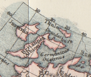
Thule as Tile on the Carta Marina of 1539 by Olaus Magnus, where it is shown located to the north west of the Orkney islands,
with a "monster, seen in 1537", a whale ("balena"), and an orca nearby.
https://en.wikipedia.org/wiki/Olaus_Magnus
Geschichte König Gustavs des Ersten, von Olau Celsio, aus dem Schwedischen übersetzt, 1753:
(keyword Cardinal Quirino: https://books.google.de/books?id=7_ZYAAAAcAAJ&printsec=frontcover#v=onepage&q&f=false
http://www.bbc.com/future/story/20160614-maps-have-north-at-the-top-but-it-couldve-been-different
The semantics of Icelandic Orientation by Einar Haugen, 1957: http://www.tandfonline.com/doi/abs/10.1080/00437956.1957.11659646
Reconstructed Viking route to America, Brandeis University: http://vinland-map.brandeis.edu/explore/historical/index.php
https://en.wikipedia.org/wiki/Longship
Satellite image created of Disko Island by the MODIS Rapid Response Project, NASA/GSFC
Olaus Magnus The Carta Marina, 2nd edition, 1572
https://en.wikipedia.org/wiki/Sir_John_Franklin
https://en.wikipedia.org/wiki/Francis_Leopold_McClintock
https://en.wikipedia.org/wiki/Maud_(ship)
https://en.wikipedia.org/wiki/Fox_(ship)
https://www.theguardian.com/world/2014/sep/09/british-ship-1845-franklin-expedition-found-canada
https://www.theguardian.com/world/2016/sep/12/hms-terror-wreck-found-arctic-nearly-170-years-northwest-passage-attempt
https://www.amazon.de/Germania-die-Insel-Thule-Entschl%C3%BCsselung/dp/3534237579
http://www.hurstwic.org/history/articles/daily_living/text/longhouse.htm
https://en.wikipedia.org/wiki/Smøla_(island)
http://thevikingworld.pbworks.com/w/page/3941468/Viking Age Shipbuilding
https://regia.org/research/ships/Ships2.htm
https://en.wikipedia.org/wiki/Maud_(ship)
https://www.facebook.com/DrakenHaraldHarfagre/
'Meteoric Iron, telluric iron and wrought iron in Greenland', Vagn Fabritius Buchwald and Gerd Mosdal, Page 47
https://en.wikipedia.org/wiki/Disko_Bay
https://en.wikipedia.org/wiki/John_Davis_(English_explorer)